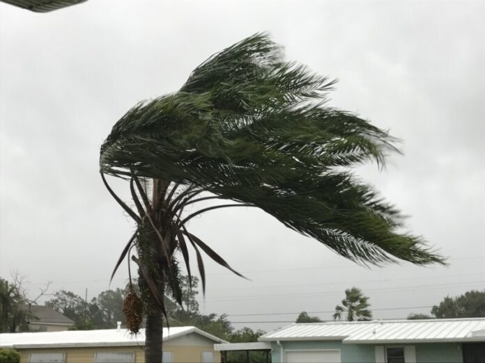
Hurricane Francine is expected to make landfall sometime early evening as a Cat 1 , maybe a Cat 2 over Louisiana.
The impacts to Tennessee’s weather will be much needed rain, a possibility of tornadoes on Thursday and Friday and strong to severe storms thru the weekend. This situation will be changing as once Francine makes landfall we can more gain a grip on which direction she will go. the farther west she tracks the lesser the chances. The farther east the more likely the chances. Here is what the NWS and NHC are saying as of the writing of this article:
For your Close to Home LIVE radar find your county here
Thursday
Showers likely, then showers and possibly a thunderstorm after 1pm. High near 76. East wind 10 to 15 mph, with gusts as high as 30 mph. Chance of precipitation is 90%. New rainfall amounts between a quarter and half of an inch possible.
Thursday Night
Showers and possibly a thunderstorm. Low around 65. East wind around 15 mph, with gusts as high as 30 mph. Chance of precipitation is 90%.
Friday
Showers and possibly a thunderstorm. High near 78. Southeast wind around 15 mph, with gusts as high as 25 mph. Chance of precipitation is 80%.
Friday Night
Showers and possibly a thunderstorm before 1am, then a chance of showers and thunderstorms after 1am. Low around 67. Southeast wind 5 to 10 mph, with gusts as high as 20 mph. Chance of precipitation is 80%.
Saturday
A chance of showers and thunderstorms, then showers likely and possibly a thunderstorm after 1pm. Mostly cloudy, with a high near 80. Southeast wind 5 to 10 mph. Chance of precipitation is 60%.
Saturday Night
A 40 percent chance of showers and thunderstorms. Mostly cloudy, with a low around 66. East southeast wind 5 to 10 mph.
Sunday
A 40 percent chance of showers and thunderstorms, mainly after 1pm. Partly sunny, with a high near 81. East southeast wind 5 to 10 mph.
Sunday Night
A chance of showers and thunderstorms before 1am, then a slight chance of showers. Mostly cloudy, with a low around 65. Chance of precipitation is 30%.
From the NHC:
As expected, Francine has strengthened and become better organized
overnight. Radar data and earlier reports from the Air Force
Hurricane Hunters indicate the eyewall is better defined, with deep
convection wrapping around the center of the hurricane. The eyewall
has contracted a bit from earlier, although it was open to the south
on the last fix and in more recent GMI passive microwave images.
The microwave data also showed some northeastward vortex tilt with
height, a sign that Francine is experiencing some effects of
southwesterly shear. Based on the earlier peak 700-mb flight-level
winds of 89 kt, the initial intensity is set at 80 kt, with a
minimum pressure of 977 mb based on aircraft data. Air Force and
NOAA Hurricane Hunter aircraft are scheduled to investigate Francine
again this morning.

The hurricane is moving northeastward at 035/9 kt. A slightly faster
northeastward motion is forecast today and tonight as the hurricane
is steered by a mid- to upper-level trough over Texas. This will
bring the core of Francine toward the Louisiana coast today, with
landfall expected within the hurricane warning area late this
afternoon or evening. After landfall, a gradual turn toward the
north will bring the center of Francine across eastern Louisiana and
Mississippi. The track guidance is fairly tightly clustered, and the
latest NHC forecast lies near the center of the guidance envelope
and very close to the consensus aids.

The structure of Francine could allow for some additional short-term
strengthening this morning over the very warm Gulf waters, and this
is reflected in the updated NHC forecast. Southwesterly shear is
expected to increase over the hurricane later today, and interaction
with an upper trough should cause drier air to wrap around the
southern portion of Francine as it nears the coast. Thus, the
hurricane is not expected to continue strengthening through
landfall, but will continue to pose a significant risk of
life-threatening storm surge and damaging winds to locations in the
warning areas. Once inland, Francine is expected to rapidly weaken,
quickly lose tropical characteristics, and transition to an
extratropical cyclone over northern Mississippi.

An experimental cone graphic that includes inland Hurricane and
Tropical Storm Watches and Warnings in the U.S. is now available on
the NHC website. Due to the time needed to compile the inland watch
and warning information, the experimental cone graphic will not be
available as quickly as the operational cone. Once it is available,
the experimental cone graphic can be found from a red weblink above
the operational cone graphic at
www.nhc.noaa.gov/graphics_at1.shtml?cone#contents. Users are
encouraged to take the experimental product survey found below the
experimental cone.

KEY MESSAGES:

1. There is a danger of life-threatening storm surge today for the
Louisiana and Mississippi coastlines, where a Storm Surge Warning is
in effect. Residents in the warning area should follow advice,
including evacuation orders, given by local officials.

2. Damaging and life-threatening hurricane-force winds are expected
in portions of southern Louisiana later today, where a Hurricane
Warning is in effect. Tropical storm conditions are expected to
begin within this area later this morning, and preparations to
protect life and property should be complete.

3. Francine is expected to bring heavy rainfall and the risk of
considerable flash and urban flooding across southeastern Louisiana,
Mississippi, far southern Alabama and northern Florida through
Thursday night. Flash and urban flooding is probable across the
Lower Tennessee Valley and Lower Mississippi Valley Wednesday night
into Friday morning.
Subscribe to our FREE Newsletter!


